EMERGENCY PLANNING SECRETARIAT
Yo:yes Sq'eq'o | Working Together


Critical Infrastructure Interdependency Analysis
Understanding how transportation disruptions in the Fraser Valley cascade across the systems our region depends on.
Our Partners


The Project
About the Project
When flooding closes a road or rail line, the impacts don't stop at the roadblock. Power, water, healthcare, and food systems all depend on transportation networks to keep functioning — and when routes fail, disruptions spread quickly across the region.
This research project examines how disruptions to transportation networks in the Fraser Valley affect critical infrastructure and local services across the broader region. Working with researchers at UBC, we are mapping the region's critical Points of Interest and developing a methodology to evaluate flood risk and identify areas of particular concern.
The First Gathering - April 2026
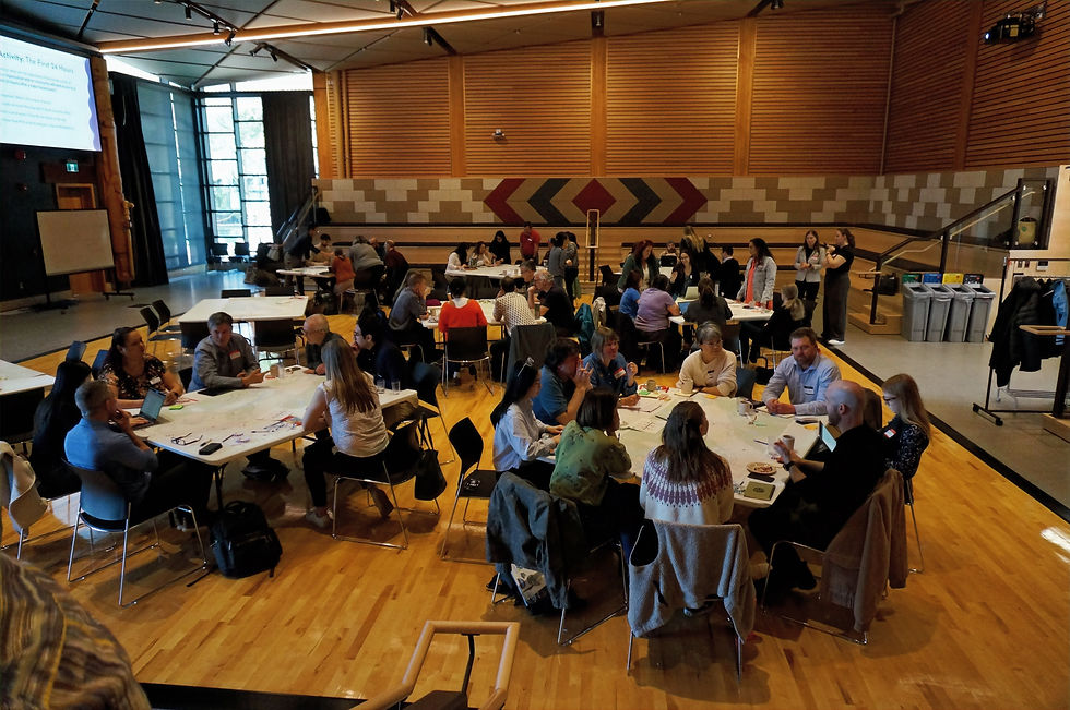
Our first gathering brought together participants from a wide range of backgrounds and areas of expertise at SFU Burnaby. Through a hands-on mapping activity, participants identified key Points of Interest across eight categories:

Transportation ·
Energy and Utilities ·
Water Management Systems ·
Health and Emergency Services ·
Food Systems ·
Community Infrastructure ·
Communications Systems ·
Industry and Economy ·
April 8th, 2026
First People's Gathering House, SFU
What We Heard
Transportation underpins everything. When routes fail, cascading impacts spread quickly across power, water, healthcare, and food systems.
The risk isn't shared equally. Rural and First Nations communities often face disproportionate challenges — many have only one access route.
Needs change as flooding persists. The first 24 hours are about life safety; as an event continues, the focus shifts to maintaining services, supply chains, and cross-jurisdictional response and recovery.
What's Next
Our team is working with UBC researchers to compile the data collected on April 8 and develop a methodology for evaluating flood risk to critical infrastructure. The wrap-up discussion also identified groups for further consultation — from utilities and health agencies to transportation operators and First Nations land use planners — and we are determining next steps for engaging them.
More gatherings are planned as the project progresses.
Project contact: Landon Reeves, Emergency Planning Secretariat | Landon.reeves@emplans.ca
This project is funded by the NRCAN Climate Resilient Coastal Communities Program.